Berlin After Reunification: How the City Changed (2026 Guide)
How Berlin transformed after 1989: Potsdamer Platz, the Reichstag dome, Ostalgie, techno, gentrification — and where to see the reunification story today.
The first time I walked across Potsdamer Platz I had to keep reminding myself that thirty-five years ago this was an empty field. Not a quiet field, not a forgotten field — a deliberately empty field, mined and watchtower-guarded, the largest patch of dead ground in central Europe. Today it’s Sony Center, Renzo Piano towers, multiplex cinemas, a Daimler atrium, and tourists eating €14 schnitzel under glass roofs. Berlin after reunification is, more than almost any other major city, a place built almost entirely in the last three and a half decades. If you’ve come here as a visitor, half of what you’ll see was deliberately created to answer a single question: what does a divided city look like once you put it back together?
This guide walks you through that answer. Not as a textbook timeline — there are plenty of those — but as a tour you can do with your feet. Every section ends with where to stand and what to look at. The story of Berlin since 1989 is a city-sized thought experiment, and the experiment is still running.
The Two Days That Reshaped Europe
Two dates matter. The first is November 9, 1989 — the night the Wall opened. The second is October 3, 1990 — the night the two Germanys formally reunified.
November 9, 1989: The Night the Wall Opened
The actual mechanism of the Wall’s fall was, famously, a press-conference mistake. Politburo spokesman Günter Schabowski, reading from notes he hadn’t fully digested, announced new travel regulations as effective “immediately, without delay” when in fact they were supposed to take effect the next morning after careful processing. Within hours, East Berliners began showing up at border crossings demanding to be let through. At Bornholmer Strasse — the first checkpoint to give way — the commanding officer, Harald Jäger, made the unilateral decision to open the gate at 11:30 p.m. rather than risk a stampede. The crossing was supposed to be temporary. The Wall never fully closed again.
Where to stand today: the Bösebrücke at Bornholmer Strasse (S-Bahn Bornholmer Strasse). A modest plaza, called Platz des 9. November 1989, and a series of information panels mark the spot. It’s quieter and more authentic than Checkpoint Charlie. If you want the full Wall context, read our Berlin Wall history timeline and our guide to Berlin Wall sites and memorials before you go.
October 3, 1990: German Unity Day
The negotiations that followed the Wall’s fall moved faster than anyone expected. By March 1990 the East had held its first (and only) free election, won by the conservative Alliance for Germany on a platform of swift unification. By July 1, 1990, the Deutsche Mark became the East German currency. The 2+4 Treaty — between the two Germanys and the four occupying powers — was signed in Moscow on September 12, 1990. And at midnight on October 3, in front of the Reichstag, the black-red-gold flag of the Federal Republic was raised over a united Germany.
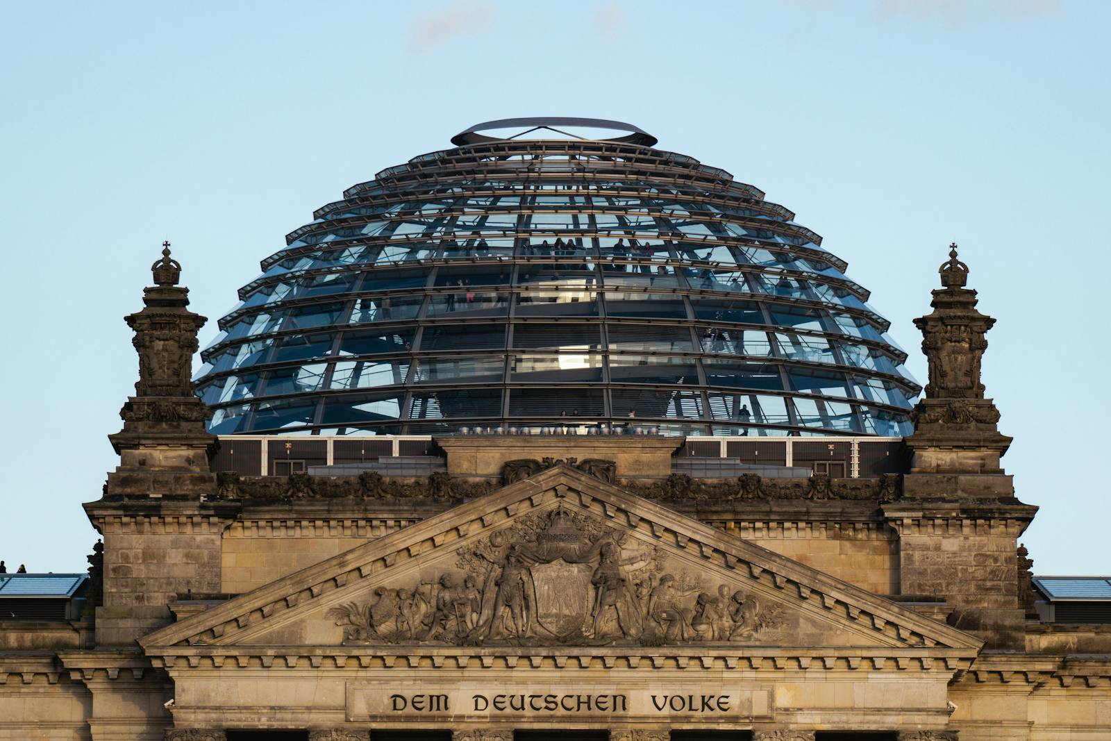
Where to stand today: the lawn of the Platz der Republik, looking up at the Reichstag with Norman Foster’s glass dome on top. Each October 3 the area is filled with a free open-air festival — beer tents, stages, a few unavoidable tourist crowds — to celebrate the Day of German Unity. If you can, plan your trip to coincide.
From No-Man’s-Land to City Center: Potsdamer Platz
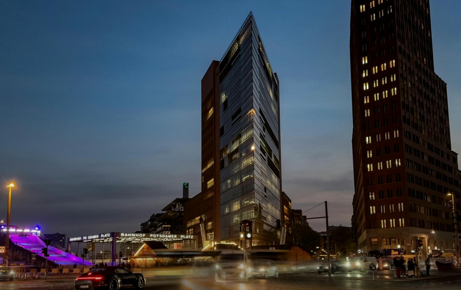
No spot in Berlin captures the post-1989 transformation more dramatically than Potsdamer Platz. In the 1920s it was Continental Europe’s busiest traffic intersection, lined with department stores and the famous Café Josty. By 1945 it was rubble. By 1961, after the Wall divided it down the middle, it was a wasteland — the so-called death strip ran straight through it, and the surface was a field of weeds, watchtowers and tank traps, the largest empty space in central Europe.
Within a year of unification, the city sold off the major plots to corporate investors — Daimler-Benz, Sony, ABB, and others — and ran an international design competition. Renzo Piano and Christoph Kohlbecker’s masterplan won in 1991. Construction began on what was then the largest building site in Europe, marketed with a famous red information cube called the Info-Box that drew 8.5 million visitors before being dismantled in 2001.
Walk it today and you’ll see the result: the Sony Center (Helmut Jahn, opened 2000) with its tent-like Forum roof and preserved fragment of the Hotel Esplanade lobby; the Kollhoff Tower with its observation deck (Panoramapunkt — Europe’s fastest elevator, claims of dubious accuracy); the DaimlerCity blocks; the new Marlene-Dietrich-Platz with its theatre and casino. Critics have called it “the central square of an airport.” That’s not entirely wrong. But standing in it, knowing what was here three and a half decades ago, the artificiality is the story.
Where to stand: Potsdamer Platz S-Bahn/U-Bahn (U2). Look down at the brass strip marking where the Wall ran. Then take the Panoramapunkt up to the Kollhoff Tower’s 25th floor for the best aerial view of the whole reunification puzzle (€9, daily 10:00–19:00).
The Government Quarter: A New Berlin Republic
On June 20, 1991, after a marathon debate, the Bundestag voted 338 to 320 to move the federal capital and the government itself from Bonn to Berlin. The margin was thin. The implications were enormous. The new capital required, more or less, a new government quarter — and over the following decade a strip of land along the Spree was filled with the buildings that now define Berlin’s political skyline.
The Reichstag and Foster’s Dome
The single most photographed building in the new Berlin Republic. The 1894 Reichstag, partially destroyed in the 1933 fire and bombed flat by 1945, sat just inside West Berlin for the entire Cold War — at one point with the Wall passing literally a few metres behind its east façade. Norman Foster’s transformation from 1995 to 1999 added the now-iconic glass dome to symbolize transparency: visitors can climb a double-helix ramp up over the heads of the politicians debating below. Booking is free but compulsory — reserve in advance at bundestag.de. The roof terrace and dome are open daily from 8:00 a.m. to midnight (last entry 22:00), and the view of the Spree, the Brandenburg Gate, and the modern government quarter from the top is one of the best free panoramas in Berlin.
Band des Bundes — The Federal Ribbon
The strip of new federal buildings running east from the Reichstag — the Chancellery, the Paul-Löbe-Haus, the Marie-Elisabeth-Lüders-Haus — was deliberately designed by Axel Schultes and Charlotte Frank to cross the Spree at two points, symbolically stitching the former East and West halves of the city back together. The Chancellery (Bundeskanzleramt), opened in 2001 by Gerhard Schröder, is the white block locals call die Waschmaschine (“the washing machine”). You can walk along the river path from the Reichstag east through the entire band — it’s an underrated free architecture tour.
The Brandenburg Gate, Restored
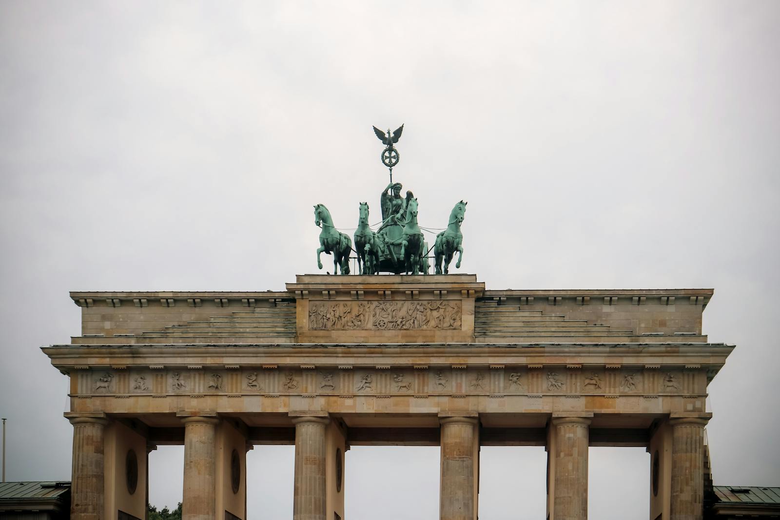
For 28 years the Brandenburg Gate stood in the death strip — visible to West Berliners across the Wall but inaccessible from either side. It reopened to traffic in December 1989 to extraordinary scenes. The surrounding Pariser Platz, gutted in WWII and used as an empty parade ground in the GDR, was rebuilt in the late 1990s and early 2000s with embassies (US, France, UK, Russia), the Adlon Hotel, the DZ Bank (with its Frank Gehry interior), and the Hotel Adlon’s reincarnation. Today it’s the most visited square in Berlin. The pedestrianisation, completed by 2002, was a quiet but symbolic victory: turning a former checkpoint into a place where you can sit on a bench.
Mitte Reborn: Hackescher Markt, Friedrichstrasse, Museum Island
Central Mitte was East Berlin throughout the Cold War — physically intact in parts, structurally crumbling in others, with neighbourhoods like Spandauer Vorstadt and the area around Hackescher Markt left in a kind of semi-ruined twilight. After 1989, artists and squatters moved into the empty buildings before the developers arrived, creating a brief and legendary cultural moment. By the late 1990s the squats had been mostly cleared and the area gentrified into the polished restaurant-and-boutique zone you see today.
Two buildings in this district tell the longer story particularly well. The first is Tacheles, the legendary art squat on Oranienburger Strasse that ran from 1990 until its eviction in 2012; it’s now a luxury apartment complex. The second is the Humboldt Forum, the reconstructed Berlin Palace that opened on July 20, 2021, on the site of the former Palast der Republik — the GDR’s parliament and concert hall, demolished controversially in 2008 after years of debate. The new building is baroque on the outside (a copy of the palace destroyed in 1950) and contemporary museum on the inside. Whatever you think of the project — and Berliners are divided — the Humboldt Forum is the single most concentrated piece of architectural reunification politics in the city. Visit. Argue with yourself about it. Then have a beer on the riverside terrace.
The whole length of Friedrichstrasse, from the station southward, was rebuilt in this period — the Galeries Lafayette and Quartier 206 are anchors of that rebuild — though commercially the street has had a rougher time than its planners hoped. Restaurant-Café-Beer-Garden Friedrichstadtpalast and the famous Tränenpalast (Palace of Tears) sit just to the north. The Tränenpalast, a small glass border-crossing pavilion from the GDR era, is now a free museum about everyday life in divided Germany — an unmissable thirty-minute stop if you’re in the area.
Tränenpalast: Reichstagufer 17, Tuesday–Sunday 9:00–19:00, free. S-Bahn Friedrichstrasse.
Architecture as Memory: Libeskind, Eisenman, Foster
One thing reunified Berlin agreed on, almost from the start, was that the new city had to take its memory seriously. Three projects, all completed in the first fifteen years after the Wall fell, became the architectural face of that commitment.
Daniel Libeskind’s Jewish Museum (Lindenstrasse 9–14), opened in 2001, was the first major statement: a zigzagging zinc-clad building whose interior axes physically embody exile, the Holocaust, and continuity. Peter Eisenman’s Memorial to the Murdered Jews of Europe (Cora-Berliner-Strasse 1), opened in 2005, became the central national memorial — 2,711 concrete stelae occupying a city block beside the Brandenburg Gate. Norman Foster’s Reichstag dome closed the loop in 1999, putting the public physically above the seat of government. For deeper context on the Jewish memorial sites, see our Jewish history in Berlin guide.
A fourth project worth mentioning: Berlin Hauptbahnhof, the new central station, opened in 2006 on the site of the old Lehrter Bahnhof — a piece of former East/West borderland that had been derelict for decades. The five-level glass cathedral is one of the largest railway stations in Europe and a defining image of the modern city.
Techno, Squats, and a Cultural Capital
This is the part of the reunification story that nobody planned and almost everybody underestimates. When the Wall came down, central Berlin — especially Mitte and the eastern districts — was suddenly full of empty buildings: state-owned, in legal limbo, with unclear ownership and no functioning real-estate market. Young people, artists, musicians and DJs moved in. Within months, illegal techno parties were happening in basements, vaults, abandoned factories, even a former Reichsbank vault.
The defining venue was Tresor, which opened in March 1991 in the safe deposit vault of the bombed-out Wertheim department store on Leipziger Strasse — a basement complete with the original safe-deposit boxes lining the walls. Tresor became the first iconic post-Wall techno club and the launch pad for the entire Berlin club scene. It relocated in 2007 to its current home in the former Vattenfall power plant on Köpenicker Strasse and is still going. Berghain — globally the most famous Berlin club — opened in 2004 in another former power plant in Friedrichshain. For more on the club scene the Wall gave birth to, see our techno clubs guide.
The squat scene in Mitte and Friedrichshain ran in parallel. Kunsthaus Tacheles (1990–2012), the legalised squat on Oranienburger Strasse, was for two decades the symbolic centre of Berlin’s alternative culture. The Eimer, the Schokoladen, Köpi (still running, on Köpenicker Strasse 137), and dozens of others made Berlin briefly the freest large city in Europe for anyone trying to live cheaply and make work that didn’t pay. The legacy: a generation of artists, musicians, writers and filmmakers who came here in the 90s and never left, and the city’s enduring branding as a cultural capital. It’s no coincidence that “poor but sexy” — Mayor Klaus Wowereit’s 2003 line — has stuck.
Ostalgie — The DDR That Won’t Disappear
Ostalgie — a portmanteau of Ost (East) and Nostalgie (nostalgia), coined in 1992 by Saxon cabaret artist Uwe Steimle — is the cultural movement that grew out of East Germans’ complicated, often loving relationship with the country that disappeared in 1990. It picked up steam in the late 1990s, hit the mainstream with the 2003 film Good Bye, Lenin!, and has since become a permanent fixture of Berlin’s cultural landscape. It’s not a politics; it’s more a wistfulness, mixed with pride, mixed with a quiet refusal to let the East become merely a footnote.
The most visible artefacts of Ostalgie are everywhere if you know where to look. The Ampelmännchen — the chubby little hat-wearing pedestrian-crossing figure designed by GDR traffic psychologist Karl Peglau in 1961 — was nearly abolished in the 1990s standardisation push and then was saved after a citizen campaign. It’s now on every East Berlin crossing, on tote bags, on bottle openers, on souvenir mugs in every gift shop. You’ll see Trabant tours puttering past — the iconic two-stroke East German car, available for guided driving tours of Wall sites. There’s Spreewald Gherkins on every menu. Karl-Marx-Allee, the grand socialist boulevard between Alexanderplatz and Frankfurter Tor, is preserved as a monument and a still-living residential street.
The best single place to engage with this is the DDR Museum (Vera-Britain-Ufer, opposite the cathedral, opened 2006). It’s interactive and family-friendly — you can sit in a Trabant simulator, open the cupboards in a recreated GDR living room, and read your own Stasi file. It’s a touch theme-park-y, which is part of the criticism, but it’s also genuinely informative and easily the most kid-friendly history museum in Berlin. Pair it with the Stasi Museum at Lichtenberg for the darker companion piece.
DDR Museum: daily 9:00–21:00, €13.50 (book online for €1 discount). Allow 90 minutes.
The Wall in the Head: Gentrification, Rent Crisis, and Lingering Divisions
If you walk Prenzlauer Berg today — wide cobbled streets, restored 19th-century facades, organic supermarkets, prams everywhere — it’s almost impossible to imagine that in 1990 this was a crumbling district of coal-heated apartments in a state of structural collapse, with most of the original housing stock unrenovated since the 1930s. The district lost roughly 70,000 of its 145,000 residents between 1991 and 1996 as buildings were renovated and locals were priced out. New tenants — mostly young, educated West Germans and internationals — moved in. Repeat the pattern, with variations, in Friedrichshain, Neukölln, Wedding, Moabit, and now Lichtenberg, and you have the gentrification map of modern Berlin.
The rent crisis is the contemporary edge of the story. Median rents in central Berlin tripled between 2008 and 2024. The 2021 referendum to expropriate landlords with more than 3,000 apartments — Deutsche Wohnen & Co. enteignen — passed with 56% support but has been mostly stymied by the courts. It’s not a tourist topic, exactly, but it’s the political backdrop to half the conversations you’ll overhear in any Kreuzberg café. If you want to see what the gentrification of an entire neighbourhood looks like in real time, walk Mauerpark (formerly Wall death strip, then a flea market and karaoke meadow, now flanked by luxury apartment blocks). Sunday afternoon for the karaoke. You’ll see everything.
And then there’s Mauer im Kopf — the Wall in the head — the phrase Germans use for the persistent cultural and economic differences between East and West that have outlasted the physical wall. It’s measurable: East Germans still earn less than West Germans on average (the gap was about 14% in 2024), still vote differently, and disproportionately occupy the bottom rather than the top of corporate and political hierarchies. You can sometimes see the line architecturally: the U-Bahn and tram networks, the building styles, the brands of streetlights. The maps of mobile phone subscriptions, organic food sales, COVID vaccination rates and AfD vote share all still show the line of the Wall, decades after it came down. It’s not a tourist sight as such, but once you know about it, you’ll see it everywhere.
The Airports: Tempelhof, Tegel, BER
Few stories illustrate the reunification-era transformation of Berlin as oddly as the airport saga. The divided city had four airports between the 1940s and 1989; the reunified city, after decades of planning and political mess, was supposed to consolidate to one. The result: a delay of nearly a decade and a folk legend about German engineering.
Tempelhof, the Nazi-era monumental airport that became famous during the 1948–49 Berlin Airlift, was closed on October 30, 2008, after years of public protest. The grounds were thrown open to the public in 2010 as Tempelhofer Feld — Berlin’s largest public space, with old runways used for cycling, skateboarding, and community gardens. A 2014 referendum decisively blocked development on the field, and it remains the city’s strangest and best park. The historic terminal building can be toured (Tempelhof Tours, ~€18, advance booking).
Tegel (TXL), the airport everybody loved for its tiny hexagonal terminal and door-to-tarmac convenience, closed on November 8, 2020. The grounds are now being redeveloped as the Urban Tech Republic and a new residential district. BER — Berlin Brandenburg Airport — finally opened on October 31, 2020, nine years late and €4 billion over budget after a series of fire-safety and planning fiascos that became national punchlines. It works fine now. The story is, in its own quietly infuriating way, very Berlin: an ambitious unified project derailed by bureaucratic chaos, eventually completed, immediately taken for granted.
Where to See the Reunification Story Today: A Walking Checklist
If you want to see the reunification story in person, this is the shortlist. Three days is comfortable. One day is possible if you’re efficient.
- Reichstag and Foster Dome — free, book ahead, sunset visit recommended.
- Brandenburg Gate and Pariser Platz — anytime.
- Potsdamer Platz and Panoramapunkt — climb the Kollhoff Tower for the aerial view.
- Bornholmer Strasse / Bösebrücke — quiet, authentic site of the first crossing.
- Berlin Wall Memorial, Bernauer Strasse 111 — the most comprehensive Wall site in the city.
- East Side Gallery — 1.3 km of painted Wall (covered in our East Side Gallery guide).
- Tränenpalast, Reichstagufer 17 — free, 30 minutes, essential.
- DDR Museum — interactive history, family-friendly.
- Humboldt Forum, Schlossplatz — argue with the architecture, then have a drink on the terrace.
- Tempelhofer Feld — the runway-park, ideally on a sunny weekend.
- Karl-Marx-Allee — walk between Alexanderplatz and Frankfurter Tor.
- Mauerpark on a Sunday — gentrification in action, plus karaoke.
- Tresor (or Berghain if you can get in) — the techno legacy live.
Mix any half-dozen of those and you’ve seen more of the reunification story than most lifelong Berliners have walked through this year.
The gate itself is where most of this became visible to the world. It stood inside the border strip from 1961, unreachable from either side for twenty-eight years, and the crossing did not reopen until 22 December 1989 — several weeks after the Wall opened elsewhere. If you want to stand on that ground and understand what you are looking at, our Brandenburg Gate guide covers the full sequence along with the practicalities of visiting.
Frequently Asked Questions
When did Berlin reunify?
The Berlin Wall opened on November 9, 1989, and the two Germanys formally reunified on October 3, 1990 — German Unity Day. Berlin’s status as the federal capital was confirmed by Bundestag vote on June 20, 1991. The two halves of the city were administratively merged starting in 1990 and reorganised into 12 districts in 2001.
What changed in Berlin after the Berlin Wall fell?
Almost everything. The death strip became Potsdamer Platz, the government quarter, and Berlin Hauptbahnhof. East German neighbourhoods were renovated and gentrified, displacing many original residents. Empty buildings birthed the techno scene and a global cultural reputation. Two airports closed, one opened. The government moved from Bonn. The total population, after a long decline, climbed back above pre-1989 levels and now exceeds 3.8 million.
Can you still see the Berlin Wall today?
Yes, in many places. The best preserved is the Berlin Wall Memorial on Bernauer Strasse 111 (open-air, free, daily). The longest remaining painted section is the East Side Gallery on Mühlenstrasse. Smaller fragments survive at the Topography of Terror, Potsdamer Platz, and the Niederkirchnerstrasse site. A continuous double cobblestone line runs through central Berlin marking where the Wall stood — keep your eyes on the pavement.
What is the “Wall in the Head”?
Mauer im Kopf is the German phrase for the cultural, economic, and political differences between East and West Germans that have outlasted the physical Wall. It shows up in income statistics, voting patterns, social attitudes, and even brand preferences. It’s narrower than it was in 1990, but it hasn’t disappeared.
Why did Berlin become a techno capital after reunification?
Three reasons: cheap rent, empty buildings, and unclear ownership. Central East Berlin in 1990–1995 was full of unused state property in legal limbo, often without electricity or formal owners. Young people moved in, threw parties in the basements, and created the first generation of post-Wall clubs (Tresor, Planet, E-Werk, WMF). The scene survived because Berlin remained affordable for decades longer than other European capitals.
What is the best place in Berlin to learn about reunification?
The Tränenpalast (Palace of Tears) is the best free museum specifically on division and unification. The DDR Museum is the most interactive. The Berlin Wall Memorial on Bernauer Strasse is the most comprehensive site on the Wall itself. For the broader Cold War context, add the Stasi Museum.
When did Germany move its capital from Bonn to Berlin?
The Bundestag voted on June 20, 1991 (338 to 320) to move the seat of government. The physical move of the government from Bonn to Berlin took place between 1999 and 2003. The Bundestag itself held its first session in the renovated Reichstag in April 1999.
Is Berlin still divided into East and West?
Not administratively — Berlin has been a single city since 1990, organised into 12 districts since 2001 (when, for example, the former West Berlin district of Kreuzberg was merged with the former East district of Friedrichshain). But culturally, economically, and architecturally, you can still trace the line of the Wall through the city if you know what to look for. The U-Bahn map, the streetlights, the architecture of the apartment blocks, and certain neighbourhood demographics all still bear the imprint of forty years of division.
Continuing the Story
The reunification story is one strand of a longer history. To put it in context, read our Berlin Wall history timeline for the lead-up, our Berlin Wall sites and memorials guide for the physical traces, and our main Berlin history and culture guide for the whole arc. If you’d rather see the city’s Cold War surveillance state up close, the Stasi Museum guide is the companion piece. And if you’re planning a longer trip and want to slot reunification sites into an itinerary, the city’s Checkpoint Charlie and East Side Gallery guides each include practical day-planning advice.
Reunification didn’t end in 1990. It’s still happening, in the rents, the politics, the architecture, and the half-finished arguments you’ll overhear in a Mitte café. Walk the city slowly. The story is still going.